ucam-eo
Python library for the Tessera embeddings
Safety scan
A static text scan, not a guarantee. Select the badge to see what was scanned and every finding.
Check it deeper on your machine
It has changed since its scan on 11 Nov 2026. Its scripts were only partly scanned.
As a Claude Code plugin, install it and then ask Claude Code:
/plugin marketplace add keithmackay/mackayi/plugin install scanskillsafety@mackayiDo a deep scan of https://github.com/ucam-eo/geotessera with scanskillsafety
Or from a terminal, clone it and run it:
git clone https://github.com/keithmackay/scanskillsafety-skill ~/.claude/skills/scanskillsafetynode ~/.claude/skills/scanskillsafety/cli.cjs --deep 'https://github.com/ucam-eo/geotessera'
It checks the exact commit: every file, its packages against OSV (api.osv.dev), how it compares with this page's scan (findsafeskills.com receives the repository's address), and, if you agree, Claude reading every file with your own Claude subscription. It never runs the code.
Badge for your README

Markdown
[](/listings/ucam-eo--geotessera)HTML
<a href="/listings/ucam-eo--geotessera"><img src="/api/listings/ucam-eo--geotessera/badge.svg" alt="findsafeskills safety rating" /></a>Install
Install instructions from the README
As written by the repo's author. findsafeskills has not verified these steps.
GeoTessera requires Python 3.12 or later.
pip install geotessera
For development:
git clone https://github.com/ucam-eo/geotessera
cd geotessera
uv sync --all-extras --dev   # or: pip install -e ".[docs]"
Sphinx lives in the `docs` extra and the test harness in the `dev` group, so a plain `pip install geotessera` pulls in neither.
What was scanned
The files the safety scan read, as written by the repository's author and shown as plain text. Lines with a finding are marked.
.claude-plugin/marketplace.json · Manifest · 12 lines
View this file on GitHub (read at the repository's current version: the scan did not record which commit it read)
- {
- "name": "ucam-eo",
- "owner": { "name": "Anil Madhavapeddy" },
- "plugins": [
- {
- "name": "geotessera",
- "source": "./",
- "description": "Teach coding agents to read Tessera satellite embeddings via the geotessera zarr interface",
- "version": "0.11.0"
- }
- ]
- }
README.md · README · 806 lines
View this file on GitHub (read at the repository's current version: the scan did not record which commit it read)
- # GeoTessera
- GeoTessera is a Python library for reading, exporting, and displaying Tessera embeddings.
- > ## 🚀 TESSERA v2 is here
- >
- > **The TESSERA v2 code is now live** — model weights and inference code are
- > available in the [`ucam-eo/tessera`](https://github.com/ucam-eo/tessera)
- > repository. v2 is our next-generation pixel-wise Earth foundation model; see
- > the preprint, [*TESSERA v2: Scaling Pixel-wise Earth Foundation Models*](https://arxiv.org/abs/2607.03949).
- >
- > **Want to try v2 embeddings early?** You can **pre-request** v2 embeddings for
- > your region and become an early tester:
- >
- > - 👉 **[Submit a v2 Embedding Pre-Request](../../issues/new?template=v2-embedding-prerequest.yml&labels=v2-embedding-prerequest)**
- >
- > ⚠️ **Heads-up:** we are still ramping up the compute, storage, and release
- > infrastructure for v2, so v2 embeddings will be produced **slowly** at first
- > and there is **no guaranteed turnaround time**. **If you need embeddings now,
- > use v1.1 instead** — [wall-to-wall global coverage](#global-coverage) for
- > 2017–2025 is available today.
- ## Overview
- GeoTessera provides access to geospatial embeddings from the [Tessera
- foundation model](https://github.com/ucam-eo/tessera), which processes
- Sentinel-1 and Sentinel-2 satellite imagery to generate 128-channel
- representation maps at 10m resolution. These embeddings compress a full year of
- temporal-spectral features into dense representations optimized for downstream
- geospatial analysis tasks. Read more details about [the model](https://github.com/ucam-eo/tessera).
- The [Zarr API](#cloud-native-zarr-access) reads selected points and regions
- from the cloud store and returns dequantized values on their native UTM
- grid. The [tile API](#python-api) downloads individual NPY or GeoTIFF files
- for offline use; NPY tiles are deprecated and will be removed.
- ### Stream regions to GeoTIFF or a web map
- `download` reads from Zarr by default and writes one GeoTIFF per UTM zone.
- `webmap` reads three embedding bands and creates an RGB web map.
- ```bash
- geotessera download --bbox '-3.0,53.4,-2.9,53.5' --year 2024 --output region/
- geotessera webmap --bbox '-3.0,53.4,-2.9,53.5' --year 2024 --output map/ --serve
- ```
- GeoTIFFs contain float32 embeddings on the native grid, with NaN nodata.
- Use `--bands` to select zero-based bands, `--depth` to select a published
- embedding prefix, or `--store-url` to read another Zarr store.
- Country and vector regions select their bounding boxes.
- Rerunning a Zarr export replaces its completed files. Use `--source tiles`
- for individual tiles that skip existing files on rerun. `--format npy`
- also selects individual tiles.
- Every download records its dataset version and variant in
- `tessera_metadata.json` in the output directory, and GeoTIFFs record them
- in their tags. Downloading into a directory that holds another dataset,
- or merging GeoTIFFs of different datasets, fails.
- Web maps reuse matching completed mosaics and tiles. Keep the output
- directory and its JSON completion files. Use `--force` to refresh a map
- when the source changes at the same URL, or `geotessera serve map/` to
- view an existing map without regenerating it.
- See the [CLI reference](https://geotessera.readthedocs.io/en/latest/cli_reference.html)
- for options, output files, and restart behavior.
- ### Global coverage
- Since GeoTessera 0.11, the default `v1.1-dclimate` dataset provides
- **wall-to-wall global v1.1 embeddings for every year from 2017 to 2025**.
- No request is needed; `GeoTesseraZarr()` and `geotessera download` read
- any land area directly.
- We recommend v1.1 for all users. Earlier versions remain selectable to
- reproduce existing results.
- If you find missing or defective embeddings, please
- **[open an issue](../../issues/new?template=embedding-request.yml&labels=embedding-request)**
- with the bounding box (lon,lat, 4 decimals) and year(s).
- ## Table of Contents
- - [Installation](#installation)
- - [Cloud-Native Zarr Access](#cloud-native-zarr-access)
- - [Architecture](#architecture)
- - [Quick Start](#quick-start)
- - [Python API](#python-api)
- - [CLI Reference](#cli-reference)
- - [Registry System](#registry-system)
- - [Data Organization](#data-organization)
- - [Contributing](#contributing)
- ## Installation
- GeoTessera requires Python 3.12 or later.
- ```bash
- pip install geotessera
- ```
- For development:
- ```bash
- git clone https://github.com/ucam-eo/geotessera
- cd geotessera
- uv sync --all-extras --dev # or: pip install -e ".[docs]"
- ```
- Sphinx lives in the `docs` extra and the test harness in the `dev` group, so a
- plain `pip install geotessera` pulls in neither.
- ## Cloud-Native Zarr Access
- The Zarr API reads selected pixels from the public store and returns
- dequantized float32 embeddings. Point and region reads use the native UTM
- grid. Patches can combine pixels across zone boundaries.
- ```python
- from geotessera import GeoTesseraZarr
- gt = GeoTesseraZarr() # v1.1 dClimate Icechunk store
- print(gt.years) # [2017, ..., 2025]
- # One embedding, with a status explaining any missing value
- vec, status = gt.probe(0.12, 52.20, year=2024)
- print(status) # 'valid', 'water', 'nodata', or 'outside'
- # Many points, one bulk read per UTM zone
- X = gt.sample_points([(0.12, 52.20), (-2.97, 53.44)], year=2024) # (2, 128)
- # A lon/lat bounding box as a mosaic on the native UTM grid
- bbox = (0.05, 52.15, 0.20, 52.25)
- mosaic, transform, crs = gt.read_region(bbox, year=2024)
- # A fixed-size patch centred on a point, merged across UTM zones when needed
- patch, transform, crs = gt.read_patch(0.12, 52.20, year=2024, size_px=256)
- # Stream a large region in row strips rather than holding it in memory
- for block, transform, crs in gt.iter_region(bbox, year=2024, strip_rows=512):
- predictions = model.predict(block.reshape(-1, 128))
- ```
- Export a region without holding the full array in memory:
- ```python
- files = gt.export_geotiffs(bbox, 2024, "region/", bands=[0, 1, 2])
- ```
- `gt.dataset` names the published dataset being read, such as
- `1.1-dclimate`. Exports record it in their tags and in the directory's
- `tessera_metadata.json`, and exporting into a directory that holds
- another dataset fails.
- Other dataset versions are selected by store URL. v2 stores also publish
- matryoshka prefixes. `depth=16` reads the first 16 dimensions; the bytes
- transferred depend on the store's chunk layout:
- ```python
- from geotessera.registry import zarr_store_url
- gt = GeoTesseraZarr(zarr_store_url("v2"))
- X16 = gt.sample_points([(0.12, 52.20)], year=2024, depth=16) # (N, 16)
- ```
- A location ending in `.icechunk` opens an Icechunk repository. Its UTM zone
- and hemisphere groups read as one `utmNN` zone on the northern CRS, with
- negative northings south of the equator; NaN scales mark unembedded pixels,
- reported as `nodata`.
- Set `cache_dir` to persist Zarr metadata between runs. Byte-range reads
- of sharded embeddings are cached within the process. Icechunk stores,
- including the default, ignore it.
- ```python
- gt = GeoTesseraZarr(zarr_store_url("v2"), cache_dir="tessera-cache")
- ```
- For direct access to one UTM zone, `gt.open_zone(lon=0.15)` returns an xarray
- dataset with a `.tessera` accessor that works in that zone's own eastings and
- northings. The store layout follows the `geoemb:` convention for geospatial
- embedding data; the
- [zarr quickstart](https://geotessera.readthedocs.io/en/latest/zarr_quickstart.html)
- and the [examples repository](https://github.com/ucam-eo/geotessera-examples)
- walk through complete workflows.
- ### Agent Skill
- The repository ships an [Agent Skill](https://agentskills.io) that teaches
- coding agents the zarr interface. Claude Code users can install it as a
- plugin:
- ```
- /plugin marketplace add ucam-eo/geotessera
- /plugin install geotessera@ucam-eo
- ```
- The skill itself is [`skills/geotessera/SKILL.md`](skills/geotessera/SKILL.md),
- in the open Agent Skills format, so it also works with other
- SKILL.md-compatible agents when copied into their skills directory.
- ## Architecture
- ### Core Concepts
- This section describes the tile download interface; the
- [zarr backend](#cloud-native-zarr-access) above streams the same embeddings
- without downloading files. The tile workflow has two steps:
- 1. **Retrieve embeddings**: Fetch raw numpy arrays for a geographic bounding box
- 2. **Export to desired format**: Save as raw numpy arrays or convert to georeferenced GeoTIFF files
- ### Coordinate System and Tile Grid
- The Tessera embeddings use a **0.1-degree grid system**:
- - **Tile size**: Each tile covers 0.1° × 0.1° (approximately 11km × 11km at the equator)
- - **Tile naming**: Tiles are named by their **center coordinates** (e.g., `grid_0.15_52.05`)
- - **Tile bounds**: A tile at center (lon, lat) covers:
- - Longitude: [lon - 0.05°, lon + 0.05°]
- - Latitude: [lat - 0.05°, lat + 0.05°]
- - **Resolution**: 10m per pixel (variable number of pixels per tile depending on latitude)
- ### File Structure and Downloads
- When you request embeddings, GeoTessera downloads files over HTTPS from the
- public Source Cooperative repository into the output directory you specify,
- where they persist for re-use:
- #### Embedding Files (via `fetch_embedding`)
- 1. **Quantized embeddings** (`grid_X.XX_Y.YY.npy`):
- - Shape: `(height, width, 128)`
- - Data type: int8 (quantized for storage efficiency)
- - Contains the compressed embedding values
- 2. **Scale files** (`grid_X.XX_Y.YY_scales.npy`):
- - Shape: `(height, width)` or `(height, width, 128)`
- - Data type: float32
- - Contains scale factors for dequantization
- 3. Use `geotessera.dequantize_embedding(quantized_embedding, scales)` to
- dequantize arrays. The helper handles scale broadcasting and missing values.
- 4. **Persistent Storage**: Files are downloaded into your chosen output
- directory and skipped on rerun, so interrupted downloads resume cleanly
- #### Landmask Files (for GeoTIFF export)
- When exporting to GeoTIFF, additional landmask files are fetched:
- - **Landmask tiles** (`grid_X.XX_Y.YY.tiff`):
- - Provide UTM projection information
- - Define precise geospatial transforms
- - Contain land/water masks
- - Cached alongside the embedding tiles for re-use
- ### Data Flow
- ```
- User Request (lat/lon bbox)
- ↓
- Parquet Registry Lookup (find available tiles from manifest.parquet)
- ↓
- HTTPS Downloads from Source Cooperative to Output Directory (integrity verified)
- ├── embedding.npy (quantized) → output dir
- └── embedding_scales.npy → output dir
- ↓
- Dequantization (multiply arrays)
- ↓
- Output Format
- ├── NumPy arrays → Direct analysis
- └── GeoTIFF → GIS integration
- ```
- **Storage Note**: Only the Parquet manifests (tens to a couple of hundred
- MB per dataset) are cached under `~/.cache/geotessera`. Embedding tiles are
- downloaded on demand into the output directory you specify and persist there
- for re-use across runs.
- ## Quick Start
- ### Check Available Data
- Before downloading, check what data is available:
- ```bash
- # Map the default v1.1 dclimate dataset from its tile registry
- geotessera coverage --output coverage_map.png
- # Map it for the UK, or for one year
- geotessera coverage --country uk
- geotessera coverage --year 2024 --output coverage_2024.png
- # Map NPY tile coverage, with coverage.json and globe.html
- geotessera coverage --dataset-variant cambridge --output tiles_coverage.png
- ```
- ### Download Embeddings
- Download individual tiles as NumPy arrays or GeoTIFF files. Tiles are
- deprecated and will be removed. v1.1 tiles exist only for the `cambridge`
- variant, which these commands use with a warning; add
- `--dataset-variant cambridge` to select it explicitly.
- ```bash
- # Download as GeoTIFF (default, with georeferencing)
- geotessera download --source tiles \
- --bbox "-0.2,51.4,0.1,51.6" \
- --year 2024 \
- --output ./london_tiffs
- # Download quantized arrays with scales and landmasks.
- geotessera download --source tiles \
- --bbox "-0.2,51.4,0.1,51.6" \
- --format npy \
- --year 2024 \
- --output ./london_arrays
- # Download using a GeoJSON/Shapefile region
- geotessera download --source tiles \
- --region-file cambridge.geojson \
- --format tiff \
- --year 2024 \
- --output ./cambridge_tiles
- # Download specific bands only
- geotessera download --source tiles \
- --bbox "-0.2,51.4,0.1,51.6" \
- --bands "0,1,2" \
- --year 2024 \
- --output ./london_rgb
- ```
- ### Create Visualizations
- Generate PCA visualizations and web maps from downloaded GeoTIFFs:
- ```bash
- # Create a PCA mosaic from downloaded tiles
- geotessera visualize ./london_tiffs pca_mosaic.tif
- # Use histogram equalization for maximum contrast
- geotessera visualize ./london_tiffs pca_balanced.tif --balance histogram
- # Create web tiles and serve interactively
- geotessera webmap pca_mosaic.tif --serve
- # Serve existing web visualizations locally
- geotessera serve ./london_web --open
- ```
- ## Python API
- ### Core Methods
- The `GeoTessera` class downloads embedding tiles as files; for streaming
- access use the [zarr backend](#cloud-native-zarr-access). NPY tiles are
- deprecated and will be removed. v1.1 tiles exist only for the `cambridge`
- variant, which `GeoTessera()` uses with a warning; pass
- `dataset_variant="cambridge"` to select it explicitly. The tile interface
- provides two main methods for retrieving embeddings:
- ```python
- from geotessera import GeoTessera
- # Initialize the client
- gt = GeoTessera()
- # Method 1: Fetch a single tile
- embedding, crs, transform = gt.fetch_embedding(lon=0.15, lat=52.05, year=2024)
- print(f"Shape: {embedding.shape}") # e.g., (1200, 1200, 128)
- print(f"CRS: {crs}") # Coordinate reference system from landmask
- # Method 2: Fetch all tiles in a bounding box
- bbox = (-0.2, 51.4, 0.1, 51.6) # (min_lon, min_lat, max_lon, max_lat)
- tiles_to_fetch = gt.registry.load_blocks_for_region(bounds=bbox, year=2024)
- embeddings = gt.fetch_embeddings(tiles_to_fetch)
- for year, tile_lon, tile_lat, embedding_array, crs, transform in embeddings:
- print(f"Tile ({tile_lat}, {tile_lon}): {embedding_array.shape}")
- ```
- ### Export Formats
- #### Export as GeoTIFF
- ```python
- # Export embeddings for a region as individual GeoTIFF files
- # Step 1: Get the tiles for the region
- bbox = (-0.2, 51.4, 0.1, 51.6)
- tiles_to_fetch = gt.registry.load_blocks_for_region(bounds=bbox, year=2024)
- # Step 2: Export those tiles as GeoTIFFs
- files = gt.export_embedding_geotiffs(
- tiles_to_fetch=tiles_to_fetch,
- output_dir="./output",
- bands=None, # Export all 128 bands (default)
- compress="lzw" # Compression method
- )
- print(f"Created {len(files)} GeoTIFF files")
- # Export specific bands only (e.g., first 3 for RGB visualization)
- files = gt.export_embedding_geotiffs(
- tiles_to_fetch=tiles_to_fetch,
- output_dir="./rgb_output",
- bands=[0, 1, 2] # Only export first 3 bands
- )
- ```
- #### Work with NumPy Arrays
- ```python
- # Fetch and process embeddings directly
- tiles_to_fetch = gt.registry.load_blocks_for_region(bounds=bbox, year=2024)
- embeddings = gt.fetch_embeddings(tiles_to_fetch)
- for year, tile_lon, tile_lat, embedding, crs, transform in embeddings:
- # Compute statistics
- mean_values = np.mean(embedding, axis=(0, 1)) # Mean per channel
- std_values = np.std(embedding, axis=(0, 1)) # Std per channel
- # Extract specific pixels
- center_pixel = embedding[embedding.shape[0]//2, embedding.shape[1]//2, :]
- # Apply custom processing
- processed = your_analysis_function(embedding)
- ```
- ### Visualization Functions
- ```python
- from geotessera.visualization import (
- create_rgb_mosaic,
- visualize_global_coverage
- )
- from geotessera.web import (
- create_coverage_summary_map,
- geotiff_to_web_tiles
- )
- # Create an RGB mosaic from multiple GeoTIFF files
- create_rgb_mosaic(
- geotiff_paths=["tile1.tif", "tile2.tif"],
- output_path="mosaic.tif",
- bands=(0, 1, 2) # RGB bands
- )
- # Generate web tiles for interactive maps
- geotiff_to_web_tiles(
- geotiff_path="mosaic.tif",
- output_dir="./web_tiles",
- zoom_levels=(8, 15)
- )
- # Create a global coverage visualization
- visualize_global_coverage(
- tessera_client=gt,
- output_path="global_coverage.png",
- year=2024, # Or None for all years
- width_pixels=2000,
- tile_color="red",
- tile_alpha=0.6
- )
- ```
- ## CLI Reference
- Use `geotessera COMMAND --help` for command options. The
- [command reference](https://geotessera.readthedocs.io/en/latest/cli_reference.html)
- describes output formats, region selection, caching, and repeated runs.
- ### download
- Export a region from Zarr as GeoTIFFs. Add `--source tiles` for individual
- GeoTIFF tiles, or `--format npy` for quantized arrays with scales and landmasks.
- ```bash
- geotessera download --bbox '-3.0,53.4,-2.9,53.5' --bands 0,1,2 --output region/
- ```
- ### visualize
- Create a PCA mosaic from a GeoTIFF file or a directory of GeoTIFF or NPY
- tiles. One sampled PCA model and color scale are applied across the inputs.
- The output contains display-scaled uint8 components; use the original
- embeddings for analysis.
- ```bash
- geotessera visualize region/ pca.tif
- ```
- ### webmap
- Create web tiles and a viewer from an RGB GeoTIFF or a Zarr region.
- Tile generation requires the GDAL command-line tools.
- ```bash
- geotessera webmap pca.tif --output map/ --serve
- geotessera webmap --bbox '-3.0,53.4,-2.9,53.5' --output region_map/
- ```
- ### coverage
- Show data availability as a PNG map and HTML globe. Icechunk datasets,
- including the default, are drawn from their tile registry as a PNG map
- alone. Use `--by-source` to compare the datasets with NPY tiles.
- ```bash
- geotessera coverage --country 'United Kingdom' --year 2024
- ```
- ### serve
- Serve an existing map directory over HTTP. An occupied port causes an error.
- ```bash
- geotessera serve map/ --port 8001 --html viewer.html
- ```
- ### info
- List every dataset, its formats and store URLs, and summarise the selected
- dataset; or inspect local GeoTIFF and NPY files.
- ```bash
- geotessera info
- geotessera info --tiles region/
- ```
- ## Registry System
- ### Overview
- GeoTessera uses a Parquet-based registry system to efficiently manage and access the large Tessera dataset:
- - **Per-version manifests**: Each dataset version has its own `manifest.parquet`
- listing every `(year, lon, lat)` tile available for that version's variants
- - **Fast queries**: Uses pandas DataFrames for efficient spatial and temporal filtering
- - **Block-based organization**: Internal 5×5 degree geographic blocks for efficient queries
- - **Minimal storage**: Only manifest files (tens to a couple of hundred MB per dataset) are cached locally
- - **Integrity checking**: Every download is verified against the response
- `Content-Length`, and against an MD5 computed over the streamed body whenever
- the server's `ETag` is a content MD5 (single-part uploads)
- - A mismatch rejects the download and triggers a retry, so corrupt or
- truncated files never reach the cache
- ### Dataset Versions and Variants
- Tessera embeddings are published as dataset *versions* (e.g. `v1`, `v1.1`,
- `v2`) and, within a version, as *variants*, each a separate inference run.
- Embeddings from different variants do not interoperate, even within one
- version: train and predict on the same `(version, variant)`. Each variant is
- published in one or more formats:
- | Version | Variant | NPY tiles (`npy/`) | Zarr (`zarr/`) | Icechunk |
- |---------|------------------------|----------------------|------------------|--------------------------------------------------|
- | `1.0` | `vultr` (default) | `v1/` | `v1/` | — |
- | `1.1` | `dclimate` (default) | — | `v1.1-dclimate/` | `s3://tessera-embeddings/v1.1/dclimate.icechunk` |
- | `1.1` | `cambridge` | `v1.1-cam/` | `v1.1/` | — |
- | `2.0` | `2B-L~beta1` (default) | `v2-2B-L~beta1/` | `v2-2B-L~beta1/` | — |
- | `2.0` | `2B-L~beta2` | `v2-2B-L~beta2/` | `v2-2B-L~beta2/` | — |
- The default version is `v1.1`. Streamed reads (`GeoTesseraZarr()`,
- `download`, `webmap`) use the version's default variant, `dclimate`, read
- from its Zarr store on Source Cooperative; the same run is also published as
- an [Icechunk store](https://github.com/dClimate/tessera-embeddings/blob/main/docs/global-store.md).
- NPY tiles of v1.1 exist only for `cambridge`, so `GeoTessera` and
- `download --format npy` fall back to it with a warning; pass
- `--dataset-variant cambridge` to select it explicitly. `coverage` and
- `info` read the Icechunk store's Parquet tile registry in place of an NPY
- manifest. The table is `DATASETS` in `geotessera/registry.py`.
- NPY tiles are deprecated and will be removed; use Zarr or Icechunk.
- List the datasets at any time with `geotessera info`, and select them on the
- CLI with `--dataset-version` and `--dataset-variant`, or in Python:
- ```python
- gt = GeoTessera(dataset_version="v1.1", dataset_variant="cambridge")
- ```
- Use `geotessera coverage --by-source` to render each `(version, variant)` source
- in a distinct colour on the coverage map and globe viewer.
- ### Registry Sources
- The registry can be loaded from multiple sources (in priority order):
- 1. **Local file** (via `registry_path` parameter)
- 2. **Local directory** (via `--registry-dir` or `registry_dir` parameter, looks for `manifest.parquet`, falling back to the legacy `registry.parquet`)
- 3. **Remote URL** (via `registry_url` parameter)
- 4. **Default remote** (from `https://data.source.coop/tessera/tessera/npy/{dataset}/manifest.parquet`, where `{dataset}` encodes the (version, variant) pair: `v1`, `v1.1-cam`, `v2-2B-L~beta1`)
- ```python
- # Use local manifest file
- gt = GeoTessera(registry_path="/path/to/manifest.parquet")
- # Use local registry directory
- gt = GeoTessera(registry_dir="/path/to/registry-dir")
- # Use default remote manifest (downloads and caches automatically)
- gt = GeoTessera() # Default behavior
- ```
- ### Registry Structure
- The Parquet manifest contains columns for:
- - **Coordinates**: `lon`, `lat` (tile center coordinates)
- - **Year**: `year` (data year, 2017-2025)
- - **Size**: `file_size` (file size in bytes for download planning)
- ```python
- # Example manifest query
- import pandas as pd
- manifest = pd.read_parquet("manifest.parquet")
- print(manifest.head())
- ```
- ### Regenerating Manifests (Maintainers)
- The per-version manifests can be rebuilt at any time by scanning the public
- Source Cooperative repository itself — no local copy of the data is needed:
- ```bash
- # Rescan every dataset and write one manifest per npy/ directory
- # (./manifests/{v1,v1.1-cam,v2-2B-L~beta1}/manifest.parquet) plus a
- # per-version landmasks.parquet (./manifests/{v1,v1.1,v2}/landmasks.parquet)
- geotessera-registry s3scan s3://tessera/tessera/npy/ \
- --landmasks-uri s3://tessera/tessera/landmasks/ \
- --output ./manifests
- # Or scope to a single dataset — the directory name encodes the
- # (version, variant) pair, so no --variant flag is needed
- geotessera-registry s3scan "s3://tessera/tessera/npy/v1.1-cam/" \
- --landmasks-uri s3://tessera/tessera/landmasks/v1.1/ \
- --output ./manifests
- ```
- The scan uses anonymous S3 `ListObjectsV2` calls against
- `https://data.source.coop`, so no credentials are required to regenerate.
- Uploading the results does require source.coop write access, and the two
- parquet files go to *different* trees (matching where clients fetch them —
- note the npy/ tree is keyed by dataset directory, the landmasks/ tree by
- plain version):
- ```bash
- aws s3 cp manifests/v1.1-cam/manifest.parquet \
- s3://tessera/tessera/npy/v1.1-cam/manifest.parquet \
- --endpoint-url https://data.source.coop
- aws s3 cp manifests/v1.1/landmasks.parquet \
- s3://tessera/tessera/landmasks/v1.1/landmasks.parquet \
- --endpoint-url https://data.source.coop
- ```
- The `s3scan` summary panel prints these per-file upload commands for you.
- Transient listing failures (Cloudflare 503s, timeouts) are retried with
- exponential backoff; if a shard still fails after retries, the affected
- manifest is not written and the command exits non-zero so an incomplete
- manifest can never be uploaded. See the
- [maintenance guide](https://geotessera.readthedocs.io/en/latest/maintenance.html)
- for the full workflow, including caching caveats.
- ### How Registry Loading Works
- 1. **Load Parquet manifest** → Download and cache the dataset's manifest (if not local)
- 2. **Request tiles for bbox** → Query DataFrame for tiles in region
- 3. **Filter by year and variant** → Select tiles matching the requested year/variant
- 4. **Find available tiles** → Return list of matching tiles
- 5. **HTTPS download** → Fetch tiles on demand from the Source Cooperative mirror into the output directory, with integrity checks
- 6. **Persist** → Downloaded tiles stay in the output directory and are skipped on rerun
- ## Data Organization
- ### Tessera Data Structure
- ```
- Remote Server (https://data.source.coop/tessera/tessera)
- ├── npy/ # NPY embeddings + scales
- │ │ # (one dir per (version, variant) dataset)
- │ ├── v1/ # 1.0 — all variants share this dir
- │ │ ├── manifest.parquet # Per-dataset tile manifest
- │ │ └── 2024/grid_0.15_52.05/grid_0.15_52.05{,_scales}.npy
- │ ├── v1.1-cam/ # 1.1 / cambridge
- │ │ ├── manifest.parquet
- │ │ └── 2024/grid_0.15_52.05/grid_0.15_52.05{,_scales}.npy
- │ └── v2-2B-L~beta1/ # 2.0 / 2B-L~beta1 (beta)
- │ └── 2024/grid_0.15_52.05/grid_0.15_52.05{,_scales}.npy
- ├── landmasks/ # Landmask TIFFs (per version)
- │ ├── v1/
- │ │ ├── landmasks.parquet # Landmask manifest
- │ │ └── grid_0.15_52.05.tiff # Landmask with projection info
- │ ├── v1.1/
- │ │ ├── landmasks.parquet
- │ │ └── grid_0.15_52.05.tiff
- │ └── v2/
- │ ├── landmasks.parquet
- │ └── grid_0.15_52.05.tiff
- └── zarr/ # Cloud-native zarr stores
- ├── v1/ # 1.0 / vultr: 60 UTM zone groups + RGB pyramid
- ├── v1.1/ # 1.1 / cambridge
- ├── v1.1-dclimate/ # 1.1 / dclimate, the default
- ├── v2-2B-L~beta1/ # v2 stores add matryoshka
- └── v2-2B-L~beta2/ # prefix arrays (d4, d16)
- Icechunk (s3://tessera-embeddings/v1.1)
- ├── dclimate.icechunk/ # 1.1 / dclimate, one group per zone and hemisphere
- └── dclimate.registry/parts/ # Parquet tile registry
- ```
- ### Local Cache Structure
- ```
- ~/.cache/geotessera/ # Default cache location (manifests only)
- ├── v1/ # 1.0 dataset dir + v1 landmask registry
- │ ├── manifest.parquet
- │ └── landmasks.parquet
- ├── v1.1-cam/ # 1.1/cambridge dataset dir
- │ └── manifest.parquet
- ├── v1.1/ # v1.1 landmask registry
- │ └── landmasks.parquet
- ├── v2-2B-L~beta1/ # 2.0 beta dataset dir
- │ └── manifest.parquet
- └── v2/ # v2 landmask registry
- └── landmasks.parquet
- # Note: Embedding and landmask tiles are NOT stored here. They are downloaded
- # into the output directory you specify and persist there for re-use.
- ```
- ### Coordinate Reference Systems
- - **Embeddings**: Stored in simple arrays, referenced by center coordinates
- - **GeoTIFF exports**: Use UTM projection from corresponding landmask tiles
- - **Web visualizations**: Reprojected to Web Mercator (EPSG:3857)
- ## Cache Configuration
- Tile workflows cache manifests and write embedding and landmask files to
- the output directory for reuse. Zarr reads persist metadata in `cache_dir`
- and cache byte ranges within the process. Keep exported files or completed
- web map directories to reuse their data between runs.
- ### Python API
- ```python
- from geotessera import GeoTessera
- # Use custom cache directory for registry
- gt = GeoTessera(cache_dir="/path/to/cache")
- # Use default cache location (recommended)
- gt = GeoTessera()
- ```
- ### CLI
- ```bash
- # Specify custom cache directory
- geotessera download --source tiles --cache-dir /path/to/cache ...
- # Use default cache location
- geotessera download --source tiles ...
- ```
- ### Default Cache Locations
- When `cache_dir` is not specified, the registry is cached in platform-appropriate locations:
- - **Linux/macOS**: `$XDG_CACHE_HOME/geotessera` or `~/.cache/geotessera`
- - **Windows**: `%LOCALAPPDATA%/geotessera`
- ## Hash Verification
- GeoTessera verifies every downloaded file (embeddings, scales, and landmasks) against the response `Content-Length`, and additionally against an MD5 computed over the streamed body whenever the server's `ETag` is a content MD5 (a single-part upload; this covers landmask TIFFs and scales files). Large multipart-uploaded embedding tiles carry a composite ETag that is not a content hash, so they are length-checked only. A mismatch rejects the download and triggers a retry with backoff, so corrupt or truncated files never reach the cache.
- ## Contributing
- Contributions are welcome! Please see our [Contributing Guide](CONTRIBUTING.md) for details.
- This project is licensed under the MIT License - see the [LICENSE](LICENSE.md) file for details.
- ## Citation
- If you use Tessera in your research, please cite the [arXiv paper](https://arxiv.org/abs/2506.20380):
- ```bibtex
- @misc{feng2025tesseratemporalembeddingssurface,
- title={TESSERA: Temporal Embeddings of Surface Spectra for Earth Representation and Analysis},
- author={Zhengpeng Feng and Clement Atzberger and Sadiq Jaffer and Jovana Knezevic and Silja Sormunen and Robin Young and Madeline C Lisaius and Markus Immitzer and David A. Coomes and Anil Madhavapeddy and Andrew Blake and Srinivasan Keshav},
- year={2025},
- eprint={2506.20380},
- archivePrefix={arXiv},
- primaryClass={cs.LG},
- url={https://arxiv.org/abs/2506.20380},
- }
- ```
- ## Links
- - [Tessera Foundation Model](https://github.com/ucam-eo/tessera)
- - [Tessera Interactive Notebook](https://github.com/ucam-eo/tessera-interactive-map)
- - [Tessera Examples](https://github.com/ucam-eo/geotessera-examples)
- - [Documentation](https://geotessera.readthedocs.io/)
- - [PyPI Package](https://pypi.org/project/geotessera/)
- - [Issue Tracker](https://github.com/ucam-eo/geotessera/issues)
- ## Star History
- [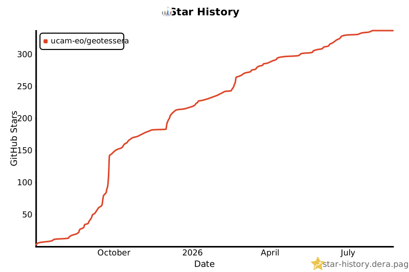](https://star-history.dera.page/#ucam-eo/geotessera&Date)
Ratings and comments
Sign in to rate this skill.
Sign inFree to use. If it’s helped, pass it on.